Unit 2: Our World's Geography
Learning Goal: Students will be learning about the geography of our world and the location of various places and features within it by identify key concepts.
Success Criteria: I know when I am successful when I can…
Success Criteria: I know when I am successful when I can…
- Locate all of the continents: North America, South America, Africa, Europe, Asia, Antarctica, and Australia
- Locate the major oceans: Arctic, Atlantic, Pacific and Indian
- Understand how to use and make a compass rose
- identify various landforms and their geographical features
- explain the location of various places based on direction (North, South, East, or West, or based on location in relation to the hemispheres or Equator)
What is Geography?There are many various definitions to the term "geography," but for our purposes, we will specifically be learning the following definition:
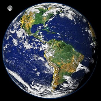
There are many different ways to divide our land in pieces to properly understand geographic regions, but the three largest are continents, countries, and provinces/states. In Grade 2, you must know the 7 continents. To remember these 7 continents, I always think of the rule - 6 As and 1 E: Africa, Asia, Antarctica, Australia, North America, South America & Europe World Map with 7 Continents 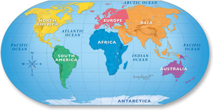
|
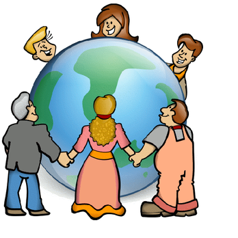
What is a community?There are many various definitions to the term "community," but for our purposes, we will specifically be learning the following definition:

|
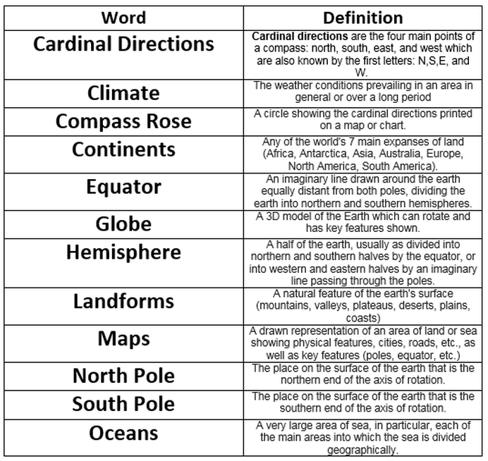
Glossary of terms
Continents and Oceans
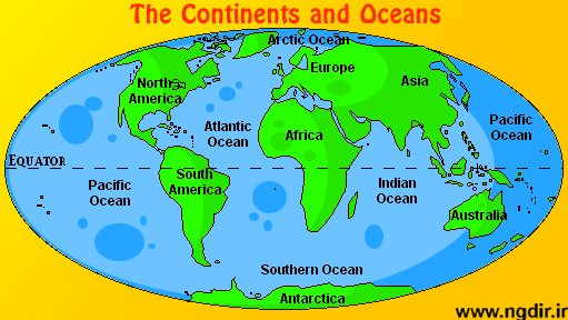
In Grade 2, students are expected to identify and be able to locate the 7 continents and 5 oceans on Earth.
|
What are the 7 Continents? Remember the 6 As and 1 E!
North America South America Africa Asia Australia Antarctica Europe |
What are the 5 Oceans? Remember PAISA!
Pacific Ocean Atlantic Ocean Indian Ocean Southern Ocean Arctic Ocean Find them all continents and ocean on the map above! |
|
|
|
Other Key terms and Concepts from our world map
Students should also be able to relate the continents and oceans to some key concepts about our world, such as: the Equator; the North Pole; the South Pole; the Northern Hemisphere; and, the Southern Hemisphere. For example, can your child answer the questions below?
- Which two continents can be found completely within the Northern Hemisphere?
- Which two continents can be found completely within the Southern Hemisphere?
- What is the Equator? How would you describe the temperature near the Equator?
- How would you describe the temperature near the North and South Poles?
- What is the only ocean completely within the Southern Hemisphere?
- What is the only ocean completely within the Northern Hemisphere?
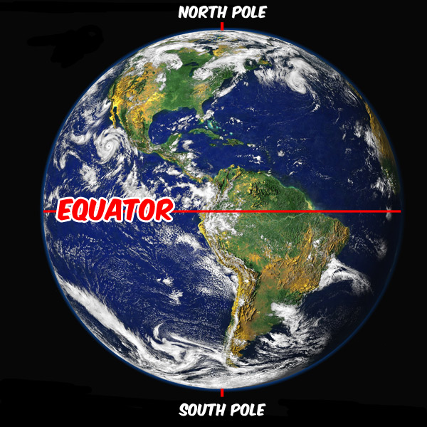
The Equator is an imaginary line drawn around the earth equally distant from both poles, dividing the earth into northern and southern hemispheres.
|
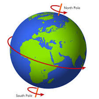
The North Pole and the South Pole are the two points at either side of our Earth on the axis on which our world rotates.
|
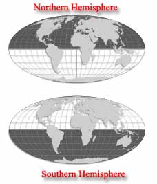
Northern Hemisphere: the half of the world NORTH of the Equator.
Southern Hemisphere: the half of the world SOUTH of the Equator. |
Compass Roses and Cardinal Directions
|
What are cardinal directions?
The four cardinal directions or cardinal pointsare the directions of north, east, south, and west, commonly denoted by their initials: N, E, S, W. East and west are at right angles to north and south, with east being in the clockwise direction of rotation from north and west being directly opposite east. |
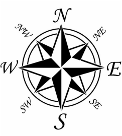
What is a 'Compass Rose'?
A compass rose is a figure on a compass or map which shows the direction of North, East, South, and West (the four cardinal directions!). This helps us read a map. Generally, on a map, up is North; right is East; down is south; and, left is West. However, we need to use a compass rose to verify this is true! If the direction are changed on the map, a compass rose will help us understand the direction our map demonstrates. |
Landforms
We know that one – fourth of the earth’s surface is covered by land. The portion which forms land on earth’s surface is not the same everywhere. At some places the land may be too high, at some places very low, some areas would be lush green and certain areas are dry and barren. Our planet earth is a beautiful collaboration of various physical features.
These different physical features are called the various landforms on the surface of the earth. These are geographical features that control the ecosystem, climate, weather and the essence of life on earth. In simple terms, we say that any shape on the earth’s surface is known as a landform. The various landforms that we have, came into existence due to natural processes such as erosion, wind, rain, weather conditions such as ice, frost and chemical actions. Natural events and disasters, such as earthquakes(the tectonic plates) and eruption of volcanoes, created the various shapes of the land that we see.
The different major landforms are mountains (and hills), coasts, valleys, plateaus, plains and deserts.
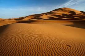
A desert is dry and sandy land.
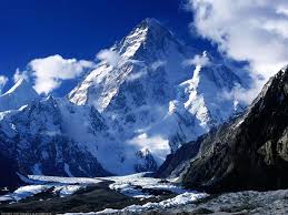
A mountain is higher than the land around it.
|
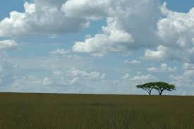
A plain is a flat landform.
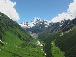
A valley is low land between mountains or hills.
|
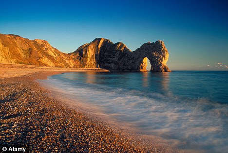
A coast is land next to the ocean.
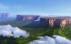
A plateau is flat and higher than the land around it.
|
